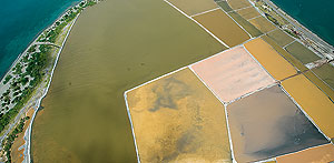
 To create a cadastral database on real properties.
Bolivar Marte, the National Cadastre Agency director announced the signing of a contract to survey by air the 395,000 cadastral units in the National District, Santo Domingo East, San Pedro de Macorís and La Romana, at a cost of US $27.0 million, as part of the Dominican Republic Cadastre Project’s first stage.
Marte explained that the new aerial surveys will create a cadastral database on real property in the urban areas near the National District and Santo Domingo East and of the municipalities with a potential for tourism.
He said of the tender offers the company Informatica El Corte Ingles won the call for tenders, after technical and economic evaluations, which also included, among others, Taldor, SP Consultores and Thomsom Reuters.
The official said the airplane will be flying in altitudes near zero to 10,000 feet throughout the cities’ urban as rural areas, which will create a guide for users to obtain an exact evaluation of their properties.

